Malaysia Distance Chart
Looking for a distance chart? If you are traveling in Malaysia and would like to know the approximate time that it will take to reach a town, the following tables provide an approximate distance in kilometres between major towns in Peninsular Malaysia.
If you are driving from Kuala Lumpur to Lumut, the approximate distance is 288 km. Out of the 288 km, about 120 km will be on the PLUS Highway of which you can travel at a speed of 110 km/hour. The balance 168 km is traveled on trunk road with an average speed of 70 km/hour.
Hence, an estimate of total time needed to travel without stopping will be:
Total time = Distance/Speed = 120/110 + 168/70
= 65 min + 144 min = 209 minutes
The total time is about 209 minutes which is approximately 3 hours and 30 minutes.
If you are traveling by bus, add another 40 minutes to compensate for the time it takes for breaks during the journey.
Distance Chart from Kuala Lumpur
| No | Kuala Lumpur To | Distance |
|---|---|---|
| 1 | Alor Star | 462 km |
| 2 | Batu Pahat | 239 km |
| 3 | Bukit Fraser | 99 km |
| 4 | Bukit Ibam | 238 km | 5 | Bukit Kayu Hitam | 510 km | 6 | Butterworth | 369 km | 7 | Dabong | 556 km | 8 | Desaru | 436 km | 9 | Dungun | 390 km | 10 | Gemas | 168 km | 11 | Grik | 359 km | 12 | Gua Musang | 290 km | 13 | Ipoh | 205 km |
| 14 | Jeli | 503 km |
| 15 | Johor Bahru | 368 km |
| 16 | Kajang | 22 km | 17 | Kangar | 507 km | 18 | Klang | 33 km | 19 | Kota Bharu | 474 km | 20 | Kota Tinggi | 383 km | 21 | Kuala Kangsar | 255 km | 22 | Kuala Lipis | 171 km | 23 | Kuala Selangor | 67 km | 24 | Kuala Terengganu | 455 km | 25 | Kuantan | 259 km |
| 26 | Lumut | 288 km |
| 27 | Melaka | 144 km |
| 28 | Mersing | 353 km | 29 | Muar | 189 km | 30 | Padang Besar | 544 km | 31 | Port Klang | 41 km | 32 | Pontian Kecil | 312 km | 33 | Port Dickson | 90 km | 34 | Seremban | 64 km | 35 | Shah Alam | 25 km | 36 | Sungai Petani | 404 km | 37 | Taiping | 291 km | 38 | Tampin | 112 km | 39 | Teluk Intan | 166 km | 40 | Temerloh | 133 km |
Distance Chart from Johor Bahru
| No | Johor Bahru To | Distance |
|---|---|---|
| 1 | Alor Star | 830 km |
| 2 | Batu Pahat | 126 km |
| 3 | Bukit Fraser | 467 km |
| 4 | Bukit Ibam | 281 km | 5 | Bukit Kayu Hitam | 878 km | 6 | Butterworth | 737 km | 7 | Dabong | 799 km | 8 | Desaru | 94 km | 9 | Dungun | 456 km | 10 | Gemas | 215 km | 11 | Grik | 727 km | 12 | Gua Musang | 605 km | 13 | Ipoh | 573 km |
| 14 | Jeli | 746 km |
| 15 | Kajang | 347 km | 16 | Kangar | 875 km | 17 | Klang | 401 km | 18 | Kota Bharu | 689 km | 19 | Kota Tinggi | 41 km | 20 | Kuala Kangsar | 623 km | 21 | Kuala Lipis | 468 km | 22 | Kuala Lumpur | 368 km | 23 | Kuala Selangor | 435 km | 24 | Kuala Terengganu | 521 km | 25 | Kuantan | 325 km |
| 26 | Lumut | 656 km |
| 27 | Melaka | 224 km |
| 28 | Mersing | 134 km | 29 | Muar | 179 km | 30 | Padang Besar | 912 km | 31 | Port Klang | 409 km | 32 | Pontian Kecil | 61 km | 33 | Port Dickson | 318 km | 34 | Seremban | 304 km | 35 | Shah Alam | 393 km | 36 | Sungai Petani | 772 km | 37 | Taiping | 659 km | 38 | Tampin | 262 km | 39 | Teluk Intan | 533 km | 40 | Temerloh | 342 km |
Terengganu | Perak | Malaysia Hotels | Airlines | Shopping
Pulau Perhentian | Beaches & Islands | Highlands | Theme Parks
Museums & History | Landmarks | Public Transports | Videos
Souvenir | Calendar 2025 | Tourism Centre | Cyberjaya | Golfing
Penang Food | KTM | Beruas Museum | Selangor | Templer's Park
Pulau Ketam | KLIA2 | Pulau Sibu | Advertise With Us
Recent Articles
-
Hiking at Sri Bintang Hill
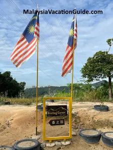 Sri Bintang Hill is a popular spot for hiking which is located near Desa Park City. It's a favourite place for may residents nearby to spend their mornings hiking.
 -
Malaysia Calendar 2026
 Here's the Malaysia Calendar 2026 for you to plan your holidays for the year 2026. Look out for the many national level open houses that you can join.
 -
Sungai Lembing Museum
 If you are within an hour or so from Sungai Lembing, plan a day out and visit Sungai Lembing Museum. Take a meal or two at this town and explore some of the attractions around this town.
 -
Selangor Fruits Valley
 Spend half a day at Selangor Fruits Valley and learn the tropical fruits and animals here. Take a ride around the valley and purchase some fruits before going back.
 -
Matang Wildlife Centre
 See the many endanger animals such as orang utans, sun bear and hornbills at Matang Wildlife Centre
New! Comments
Have your say about what you just read! Leave us a comment in the box below.